



meld je nu aan voor de terracarta branchemiddag
op woensdag 19 november
- 19 november
- Thema maakbaar ontwerp
- Railcenter Amersfoort
- 13:00 - 18:00
We mapped the locations of underground cables and pipes at nine sports parks for the City of Amsterdam. The total survey area covered more than 77 hectares. In short: a major undertaking in a densely built-up and heavily used environment.
Through the use of 3D ground-penetrating radar and the delivery of results in accordance with the NLCS standard, the project resulted in:
Reliable information about the subsurface is crucial for planning and carrying out work in and around sports parks: from routine maintenance to redevelopment and future infrastructure projects. Unknown and inaccurately mapped cables and pipes pose a direct risk to the safety and manageability of projects.
Because sports complexes are used intensively on a daily basis and had to remain open to athletes, it was necessary to conduct cable and pipeline surveys without disrupting daily activities.
The cable and pipeline survey was conducted using a multi-channel 3D ground-penetrating radar. This technology maps underground infrastructure in detail without the need for excavation or disruption to activities at the sports complexes.
In parallel with the ground-penetrating radar survey, we conducted a survey of all relevant above-ground structures: manhole covers, valves, light poles, and more. By combining above-ground and underground data, we are able to create a complete and reliable picture of the entire infrastructure.
The collected data has been interpreted and processed into a dataset in accordance with the City of Amsterdam’s NLCS standard. As a result, the information can be integrated directly into existing asset management systems without the need for conversion, additional processing steps, or any loss of quality.
Managers now have access to reliable subsurface data that enables them to make informed decisions about maintenance, redevelopment, and future projects in and around the sports parks.
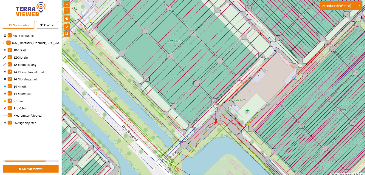
The survey results are made available via TerraViewer, TerraCarta’s online platform. Here, existing drawings are converted into structured geoinformation and combined with newly detected cables and pipelines. Above-ground fixtures such as cabinets, valves, tap points, splicing sleeves, and streetlights are also included on the map.
This gives sports facility managers access to up-to-date subsurface information anytime, anywhere: at the office while planning, or on their smartphone in the field during inspections or work.
Do you also need reliable insight into your underground infrastructure? TerraCarta accurately maps cables and pipelines with minimal disruption. Whether it’s sports complexes, industrial facilities, or public spaces, we deliver ready-to-use data that meets your standards.
Contact us and find out what we can do for you.
Would you like to learn more, or are you curious about what we can do for you? Feel free to contact us—we’d be happy to tell you more!