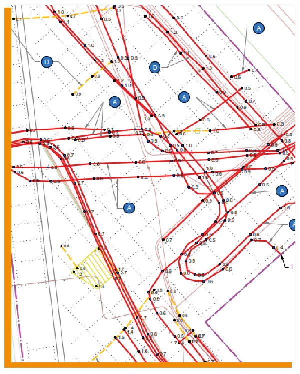
Every project goes through various phases in accordance with the CROW 500 guideline. As the project progresses, the need for reliable and detailed information about the subsurface increases. While a general overview is sufficient in the early stages, maximum accuracy is required during the design phase to manage risks.
Understanding the Subsoil
at every stage of your project
Every project goes through various phases in accordance with the CROW500 guideline. As you progress through this process, the need for reliable and detailed information about the underground infrastructure increases. While a general overview may suffice in the early stages, the design phase requires maximum precision.
With KLICscan and complementary technologies, TerraCarta offers solutions that evolve alongside those information needs.
In the initial phase, the focus is primarily on feasibility and constructability. You want to know whether a project is feasible and what underground risks you can expect. That’s why we use a multi-channel ground-penetrating radar system. This system collects high-resolution, comprehensive ground-penetrating radar data, allowing you not only to verify the location of known cables and pipelines (via the KLIC) but also to identify new or unexpected objects.
The collected data can be presented in various ways:
KLICscan Detection Map (point cloud): a three-dimensional overview of the subsurface.
KLICscan Mapping: an overview map that gives you a quick understanding of underground structures.
KLICscan Analysis: targeted advice based on the data, tailored to your project needs.
Design Phase
targeted detailed investigation
As the project progresses, the focus shifts to detailed information. Based on the radar data already collected, it is possible to zoom in precisely on specific bottlenecks or high-risk locations.
Our data specialists process the measurements to create a detailed cable and pipeline model. Where necessary, this information can be enhanced using additional techniques, such as:
Radio detection: for precisely locating specific cables and pipes.
Test pits: physical verification at critical points for maximum assurance.
This provides a comprehensive picture of the subsoil, allowing you to make the right decisions regarding design and construction.
With KLICscan, your subsurface data evolves in step with the phases of your project. From a general overview to full detail: efficient, reliable, and secure.
What can you expect?
Here's what you get with Klicscan
Reliable data for subsurface risk assessment. High-resolution information that is immediately usable for CROW-500.
Verify KLIC data in your project area using a precise digital subsurface model.
Overview of risks (unknown, deviating, and unmatched pipelines) based on KLIC validation.
Innovation
in Process and Technology
At TerraCarta, we’ve been mapping the subsurface with precision and reliability since 2008. With KLICscan, we combine our many years of experience with the latest technology to make your subsurface projects faster, more efficient, and safer.
Our approach:
High-speed, high-resolution data acquisition using multichannel ground-penetrating radar.
Comprehensive survey: no sampling, but a complete understanding of the subsurface.
Work more efficiently: fewer test trenches needed, fewer surprises during construction.
Evolving information: from a general overview to a detailed design.
Learn more
About KLICscan?
Avoid costly delays during excavation and get started right away with the most reliable subsurface data. Fill out the contact form, and one of our experts will contact you personally within a few business days.